
The VoicePredict project aims at route prediction of people and vehicles by using of methods of machine learning, and especially deep learning. For this GPS data tracking is combined with audio data of participating indivicuals, the project seeks to develop a navigation tool that can provide accurate and time-dependent location predictions of the tracked objects.
The project involves expanding current deep learning methods, exploring their suitability for the application domain, creating statistical models from available data for algorithm development, and training the systems using these models. The goal is to answer the question, “Where will the tracked object be in n minutes?” by leveraging collected GPS and audio data.
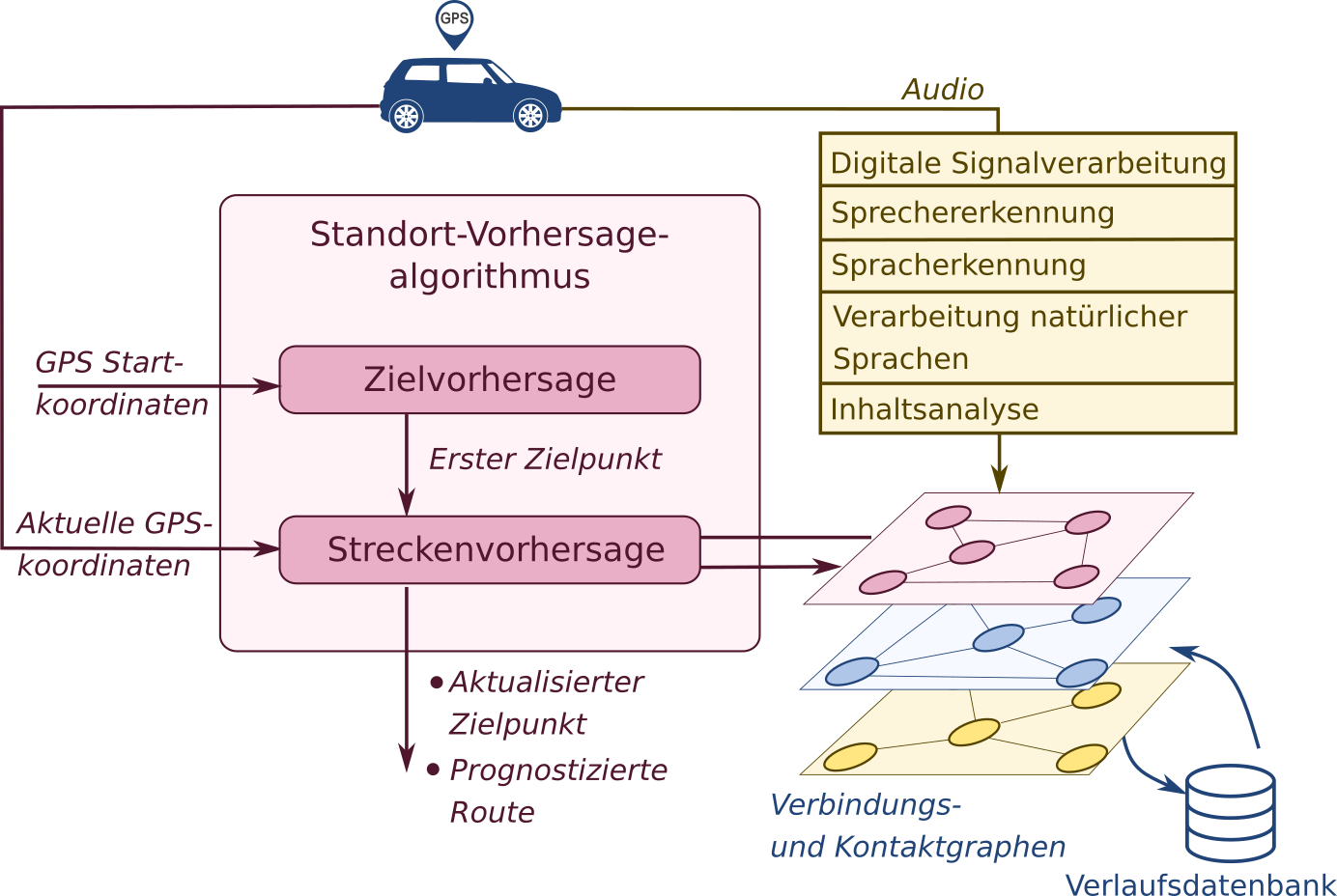
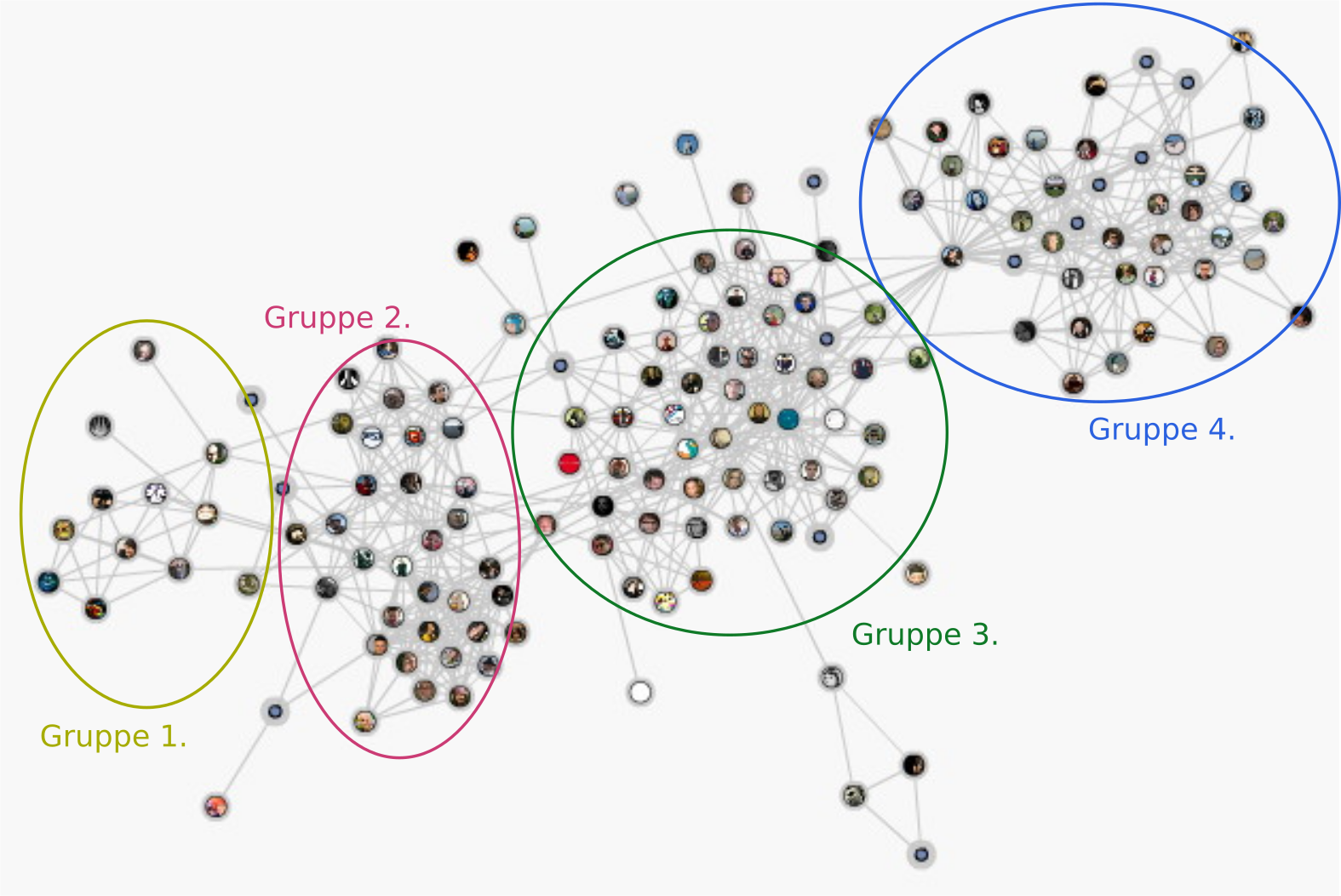
The development goal of the project is to create a location prediction system using deep learning techniques and data from various sources, such as GPS coordinate history, audio recordings, temporal dependencies between coordinates and audio content, and relationships between individuals. The system aims to improve the accuracy of predicted object positions within a close timeframe. Additionally, the project aims to identify connection and contact graphs as well as rendezvous points.
In terms of scientific and technological advancements, the project draws on current methods for destination prediction in deep learning, such as nearest neighbor classification, support vector machines, and random forest algorithms. Iterative loops involving Bayesian inference, hidden Markov models, and neural networks are employed to calculate the predicted destinations in each iteration.
In addition to route prediction, the project explores the analysis of audio data for extracting personal characteristics, such as voice features, individual information, frequently visited places, and relationships with other individuals or social groups. By correlating these features with the position estimation methods, the project aims to significantly enhance the accuracy of predicted object positions within a close timeframe.
Additionally, social graphs based on the data collected from the previous steps, revealing relationships between individuals, meeting points, important locations, or events are calculated. The developed algorithms, methods, and software enable the estimation of relationship characteristics, frequency, and more. The information obtained from the social graph can assist in predicting unknown positions and destinations of an object, as well as assigning probabilities to rendezvous points. Various data fusion techniques will be employed to integrate all available data.
The project’s methods and findings have broader applicability outside of security and law enforcement scenarios, including fleet management, logistics, tourism, and voice-controlled production processes. Therefore, successful outcomes from the project offer diverse opportunities for subsequent projects with numerous other industrial companies in the region and beyond.
Project manager –Kiril Karpov